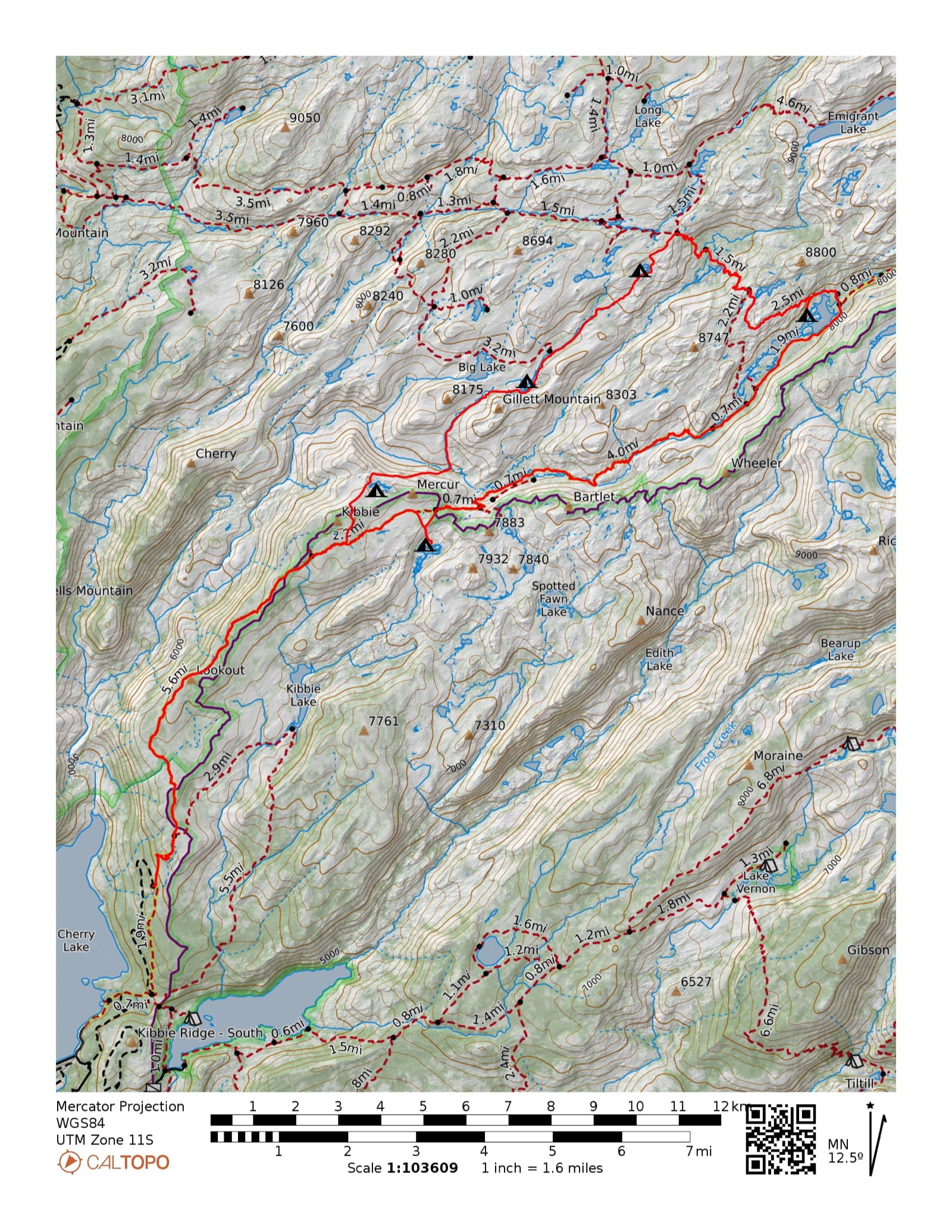
Cherry Lake > Huckleberry Lake Loop
Emigrant Wilderness · Stanislaus National Forest · Yosemite NP boundary
6 legs · 39.5 miles · +6,443 / −6,433 ft
The Country
- Wilderness
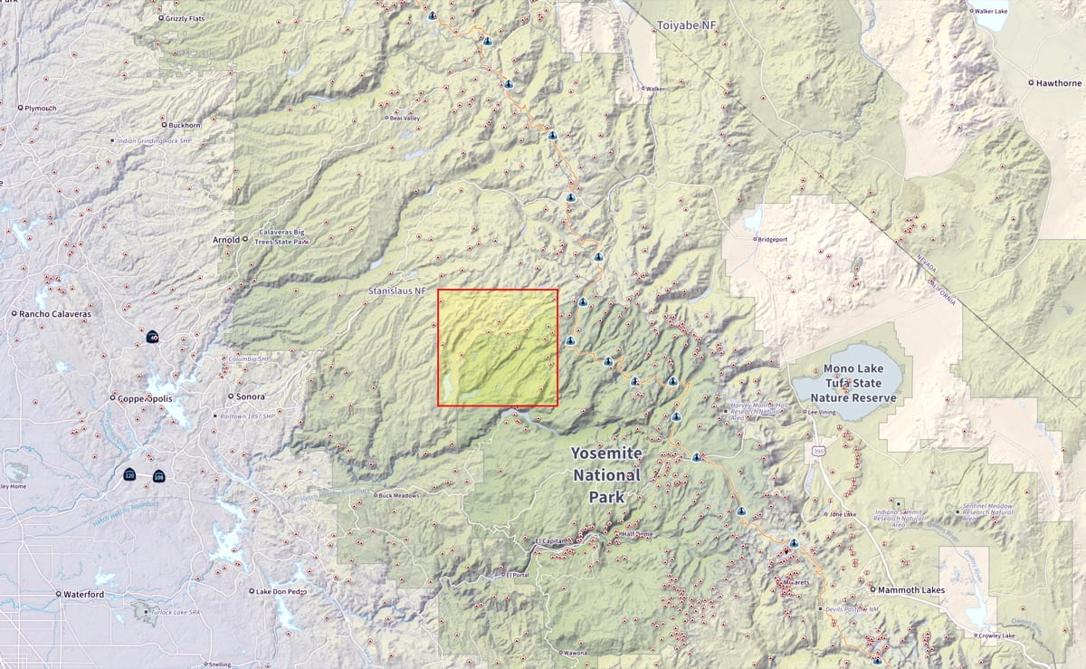
- Southern Emigrant Wilderness, Stanislaus National Forest — western-slope central Sierra. Yosemite NP boundary at Kibbie Ridge.
- Access
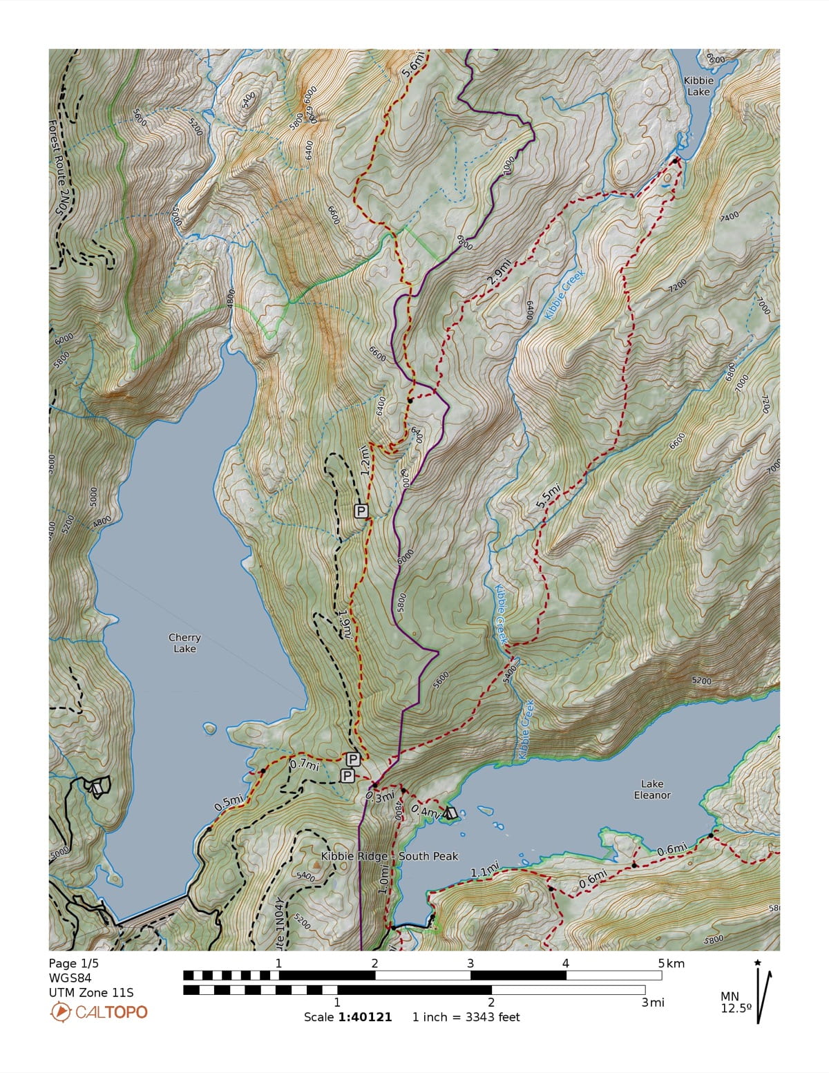
- Paved to Cherry Lake reservoir (~4,700 ft); high-clearance dirt (FR 1N04D) to Shingle Spring TH (~5,800 ft). Lower signed trailhead: Kibbie Ridge (FR 1N07, ~5,000 ft).
- Terrain
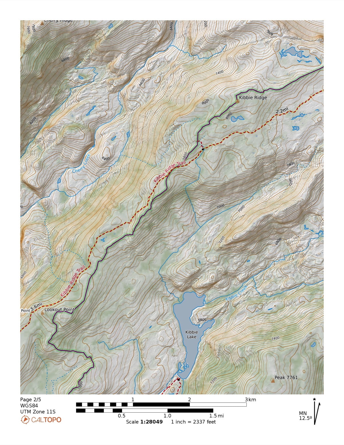
- Glaciated granite benches and lodgepole forest, dotted with lakes. Mostly on-trail with short cross-country segments.
- Elevation
- Route spans 5,879–8,442 ft. High point ~8,442 ft at the Red Can–Huckleberry divide (leg 4).
- Destination
- Huckleberry Lake (~7,700 ft, ~200 acres) — far point of the loop.
- Season
- Roughly July–October. The ~8,400 ft divide can hold snow into early summer.
- Trailhead
- Loop · Shingle Spring TH (Cherry Lake) · FR 1N04D
- Live map
- Open CalTopo
The Route — 6 legs, clockwiseDistanceGainLoss
Cherry > Mercur Partial XC
8.5 mi
+2,380
−466
+2,380−466 ft
Trail to Sachse Spring, XC to Mercur Lake · 5,879–8,044 ft
Mercur > Yellowhammer XC
3.59 mi
+870
−922
+870−922 ft
XC descent into Cherry Creek Canyon, XC climb to Yellowhammer Lake · 6,952–7,793 ft
Yellow > Red Can XC
2.62 mi
+684
−102
+684−102 ft
XC plateau traverse to Red Can Lake · 7,728–8,336 ft
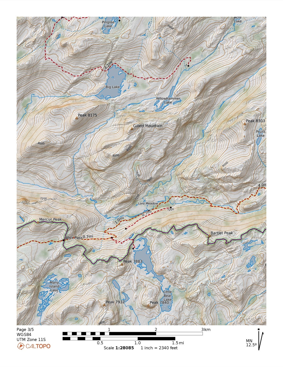
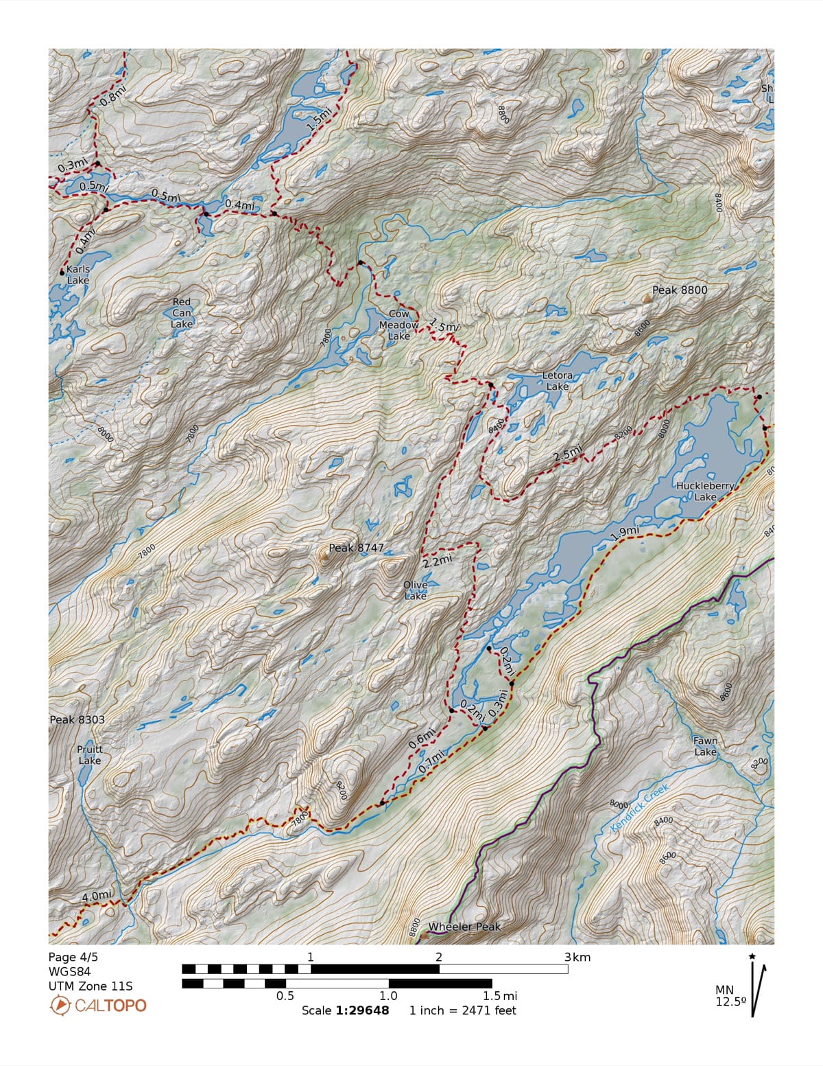
Red Can > Huckleberry Partial XC
5.42 mi
+864
−1,320
+864−1,320 ft
XC over divide to Wood Lake, trail to Huckleberry Lake · 7,791–8,442 ft
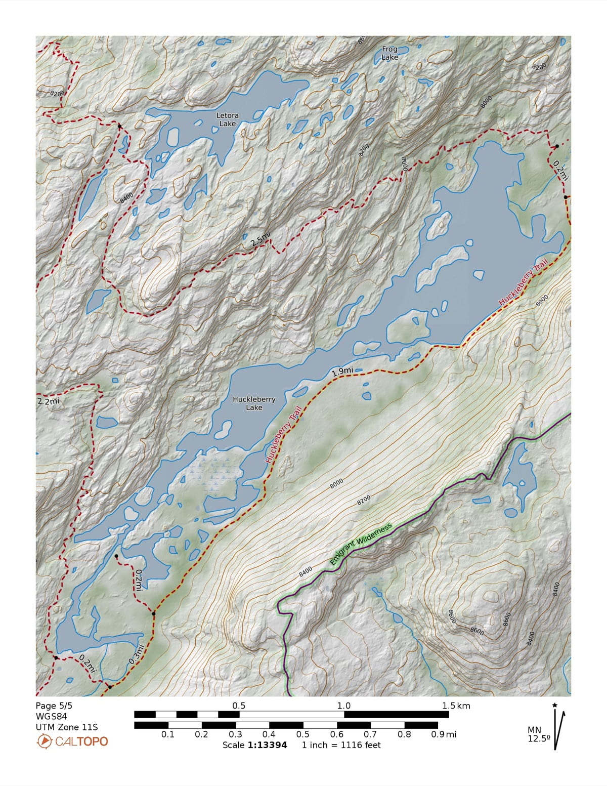
Huckleberry > Many Island Partial XC
10.15 mi
+854
−1,384
+854−1,384 ft
Trail to Styx Pass, XC descent to Many Island Lake · 7,100–7,924 ft
Many Island > Cherry Partial XC
9.22 mi
+791
−2,239
+791−2,239 ft
XC from Many Island to trail, descent to Cherry Lake / Shingle Spring TH · 5,889–7,909 ft
Total
39.5 mi
+6,443
−6,433
The Fishing
| Lake | Fishing | Trout | Size | Notes |
|---|---|---|---|---|
| Huckleberry Lake | ●●●Excellent | Rainbow & brook | to 18–20″ | Self-sustaining wild fishery in gin-clear water. Fish run big but spooky — small dries, stealth, a float tube for the deep water. The best fishing on the loop. |
| Red Can Lake | ●●●Good | Rainbow | — | Wild rainbows; work the south shore. |
| Big Lake (side trip) | ●●●Good | Rainbow | to 14–15″ | One of the more productive Emigrant lakes; wild rainbows. Access via Cherry Creek corridor. |
| Wood Lake (side trip) | ●●●Good | Rainbow | to 16″ | 24 acres at 8,298 ft; strong reputation for large rainbows. Southwest of Lower Bucks Lake. |
| Cherry Lake (trailhead) | ●●●Good | Rainbow · brook · brown · kokanee | — | Multi-species reservoir; best from a boat, or at the Cherry Creek inlet during the spring rainbow run. |
| Yellowhammer Lake | ●●●Fair | Rainbow | — | Productive water but limited spawning — usually fair. Species per inference; CDFW data thin, confirm with Groveland RD. |
| Many Island Lake | ●●●No data | — | — | No reliable reports — plan as possibly fishless. |
| Lake below Mercur | ●●●No data | — | — | Undocumented tarn near the first camp — likely marginal. |
| Five Acre Lake (side trip) | ●●●No data | — | — | No documented fishery data — too small (~5 acres) to appear in any guide. Plan as possibly marginal. |
Frog restoration. CDFW removes trout from some Emigrant lakes to restore the mountain yellow-legged frog. The one confirmed removal nearby — Camp Lake — is off-route on the northern Crabtree side, and none of this loop's lakes appear in the restoration dataset. Worth a confirmation call before a fishing-focused trip.
Huckleberry Lake: compiled from High Sierra Topix trip reports, flyfishingthesierra.com, and sierrahiker.com. Kibbie, Many Island, Grouse, and Cherry Lake: CDFW Interactive Fishing Guide and Emigrant Wilderness trip reports. Red Can, Bigelow, and unnamed tarns: CDFW data where available — west-slope data is thin and species often inferred. Confirm conditions with the Groveland Ranger District, (209) 962-7825, before counting on any specific water.
The Maps
Before You Go
- Permit
- Required April 1–Nov 30 · Quota: 25 people/day · phone-only through Groveland RD, (209) 962-7825 · not self-issue.
- Yosemite
- Route grazes the park boundary near Kibbie Ridge — any time inside Yosemite needs a separate park wilderness permit. Verify the crossing on CalTopo.
- Fires
- No fires above 9,000 ft (verify current restrictions) · stove only in the high country.
- Bears
- Canister required in Yosemite NP boundary areas · strongly recommended throughout.
- Camp
- 100+ ft from water, trails, and other parties · durable surfaces only.
Two trailhead names. The signed, official trailhead is Kibbie Ridge (FR 1N07, ~5,000 ft). The higher Shingle Spring start (FR 1N04D, ~5,800 ft) needs a high-clearance vehicle but saves ~800 ft of climbing. The permit system lists this corridor as "Shingle Springs TH / Kibbie Lake."
For More Information
Groveland Ranger District (STF)(209) 962-7825
Stanislaus NF — Supervisor's Office(209) 532-3671
Tuolumne County Sheriff — Search & Rescue(209) 533-5815